Responsible: ENSU
Involved partner: CMCC, WidePilot, ISALIT
This WP foresees the study and determination of the dispersion of pollutants in the marine environment in order to achieve an integrated management of the coastal space with activities of rapid acting that allow to minimize the impact of human activities.
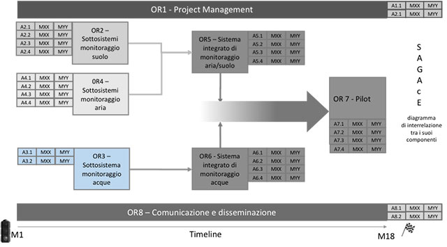
Act.3.1: The Taranto Molo San Cataldo station (which currently only detects some physical-chemical parameters with a commercially available multi-parametric sensor system) will be integrated and completed with low-cost prototype sensors to enable acquisition in continuous of data of parameters such as temperature, conductivity, chlorophyll fluorescence a, CDOM fluorescence, turbidity, dissolved oxygen, ph. In the protected area of Torre Gauceto one of the buoys will be equipped with a system of multi-parametric sensors made with low-cost prototype sensors to allow continuous data acquisition of temperature, conductivity, chlorophyll a, CDOM fluorescence parameters , turbidity, dissolved oxygen. The parameters detected will be sent to the platform developed in the WP6 which, thanks to the forecasting models, will provide indications regarding mitigation actions, in relation to the definition of the recognized vulnerable areas considering the modelled distribution of pollutants on the geomorphological characteristics of the coastal strip (rapid mapping).
Act.3.2: This activity concerns the creation of a system of rapid sampling and early warning analysis through the use of an aerial drone which, reaching the areas in which the concentration of pollutants is expected at time intervals defined by the forecasting models, will carry out the collection of water samples and the subsequent delivery to a mobile laboratory for carrying out urgent analyses. The operation can be easily repeated at the same point at different times or in other areas following the planned schedule for an accurate control of the dispersion defined from the forecast modelling.
